Etosha National Park – One of the greatest wildlife spectacles on earth – herds of elephant, black-maned lions and the world’s largest population of rare black rhinos – roam the plains of Etosha National Park, a vast area that is home to 114 large and small animal species and 340 bird species. No trip to Namibia is complete without a visit to Etosha National Park. Etosha owes its unique landscape to the Etosha Pan, a vast shallow depression of approximately 1,930 square miles which forms the heart of the park. Once part of a large inland lake fed by rivers
from the north and east, it dried up 120 million years ago as continental drift changed the slope of the land and the course of the tributaries. This white, chalky expanse colors the park, and with the waterholes, creates the characteristic atmosphere of the Etosha of today.
A series of waterholes along the southern edge of the pan guarantee rewarding and often spectacular game viewing. In good rain years the pan fills with water draining southwards from Angola via a delta-like system of shallow rivers and oshanas, drying out in the winter to become an austere expanse of white cracked mud, shimmering with mirages and upward-spiraling dust devils. Seeing vast herds of game against this eerie backdrop, referred to in the local vernacular as the ‘the place of dry water’, makes the Etosha game-viewing experience unique.
Of the 114 mammals species found in the park, several are rare and endangered, such as black rhino and cheetah, and the lesser-known black-faced impala, which is endemic to north-western Namibia and south-western Angola. Etosha’s current population of black rhino represents one of the largest growing populations of black rhino in the world.
Other large mammals in the park include elephant, giraffe, blue wildebeest, mountain and plains zebra, hyena and lion. Cheetah and leopard complete the trio of ‘big cats’. Antelope species range from kudu, gemsbok and the large and stately eland, to the diminutive Damara dik-dik. Smaller mammals include jackal, bat-eared fox, honey badger, warthog and the ubiquitous ground squirrel.
About 340 bird species occur in Etosha, about one third being migratory, including the European bee-eater and several species of wader. Larger birds include ostrich, kori bustard and greater and lesser flamingo, tens of thousands of which congregate on the pan to breed during a good rainy season. Ten of Etosha’s 35 raptor species are migratory. Those most commonly seen are lappet-faced, white-backed and hooded vultures, while sightings of the Cape, Egyptian and palm- nut vultures have been recorded. There are eight species of owl, including the pearl-spotted owlet and southern white-faced scops-owl, and four species of nightjar.


Cape Cross
The Cape Cross Seal Reserve is home to the world’s largest breeding colony of Cape fur seals. With a surrounding area of about 23 square miles consisting of flat gravel plains and a rock outcrop where the seals gather, the reserve was proclaimed in 1968 to protect the biggest and best known of the 23 colonies of Cape fur seals that breed along the coast of South Africa and Namibia. Located close the coastal towns of Swakopmund and Henties Bay, visitors can walk along the edge of the colony and learn about these interesting animals and the unique history of Cape Cross. It was here that the Portuguese navigator, Diego Cão, on his second xpedition to Africa south of the equator, planted a stone cross in 1486. Two replicas of this cross can be viewed at the site where the original one was erected.
The Cape fur seal, Arctocephalus pusillus pusillus, is the largest of the world’s nine fur-seal species. Up to 210,000 of these animals gather at Cape Cross at any one time during the breeding season. From November and December, massive bulls fight for beach territory and the right to mate. Females breed in synchrony, and spend their days fishing in the Benquela Current returning to the shore amongst thousands of pups.
Caprivi
The Caprivi regional capital is the town of Katima Mulilo, which is located on the Zambezi River. There are no other major towns in the area, although it is fairly densely populated and travellers will encounter numerous villages. The Caprivi is also the only region that shares its borders with 4 other countries – Angola, Botswana, Zambia and Zimbabwe, all members of the Southern African Development Community (SADC).
Another huge drawcard is that the Caprivi is surrounded by 4 perennial rivers – Chobe, Kwando, Linyanti and the mighty Zambezi. For years this area was the domain of the South African Army – wildlife suffered as a result- but with soldiers long gone, wildlife populations have recovered. These waterfront areas combine riverine forests with vast wetlands, attracting over 600 species of bird, 4 of the big 5 (less rhino) as well as boasting 4 National Parks – Bwabwata, Mamili, Mudumu and Mahango. Nearly 200 kinds of flora, shrubs, trees and fruits, complement the wildlife and amazing geography.
Damaraland
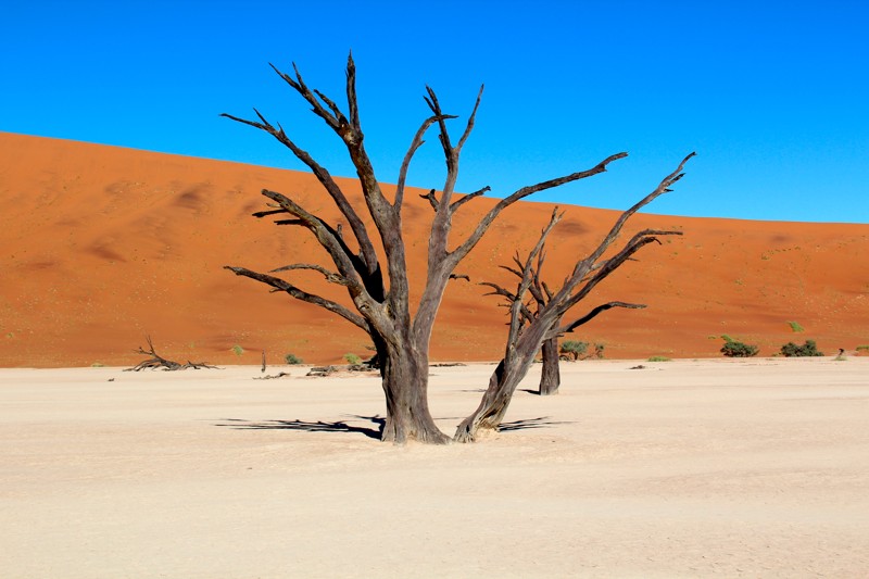
Damaraland is one of the most scenic areas in Namibia, a huge, untamed, ruggedly beautiful region that offers the more traveller a more adventurous challenge. Here there are prehistoric water courses with open plains and grassland, massive granite koppies and deep gorges. Towards the west, the geography changes dramatically with endless sandy wastes, that incredibly are able to sustain small, but wide-ranging, populations of desert-adapted elephant, black rhino, giraffe, ostrich and springbok. These animals have adapted their lifestyles to survive the harshness of the sun-blistered, almost waterless desert spaces. Elephant move through euphorbia bush country, and can travel up to 70km in a day in search of food and water and unusually, do not destroy trees in their quest for food. Follow black rhino cow and her calf in typical Damaraland ‚melkbos’ terrain. Together, Damaraland and Kaokoland are known as the Kaokoveld.
Highlights of the area include: The Brandberg, Twyfelfontein, Spitzkoppe, The Petrified Forest and The Vingerklip.
In addition to the incredible views, Damaraland is home to many animals, which still reside in the wild without any human control. Here you can meet the desert elephants, black rhinos, ostriches, giraffes, oryxs and many others.
Etosha National Park
Etosha National Park – One of the greatest wildlife spectacles on earth – herds of elephant, black-maned lions and the world’s largest population of rare black rhinos – roam the plains of Etosha National Park, a vast area that is home to 114 large and small animal species and 340 bird species. No trip to Namibia is complete without a visit to Etosha National Park. Etosha owes its unique landscape to the Etosha Pan, a vast shallow depression of approximately 1,930 square miles which forms the heart of the park. Once part of a large inland lake fed by rivers
from the north and east, it dried up 120 million years ago as continental drift changed the slope of the land and the course of the tributaries. This white, chalky expanse colors the park, and with the waterholes, creates the characteristic atmosphere of the Etosha of today.
A series of waterholes along the southern edge of the pan guarantee rewarding and often spectacular game viewing. In good rain years the pan fills with water draining southwards from Angola via a delta-like system of shallow rivers and oshanas, drying out in the winter to become an austere expanse of white cracked mud, shimmering with mirages and upward-spiraling dust devils. Seeing vast herds of game against this eerie backdrop, referred to in the local vernacular as the ‘the place of dry water’, makes the Etosha game-viewing experience unique.
Of the 114 mammals species found in the park, several are rare and endangered, such as black rhino and cheetah, and the lesser-known black-faced impala, which is endemic to north-western Namibia and south-western Angola. Etosha’s current population of black rhino represents one of the largest growing populations of black rhino in the world.
Other large mammals in the park include elephant, giraffe, blue wildebeest, mountain and plains zebra, hyena and lion. Cheetah and leopard complete the trio of ‘big cats’. Antelope species range from kudu, gemsbok and the large and stately eland, to the diminutive Damara dik-dik. Smaller mammals include jackal, bat-eared fox, honey badger, warthog and the ubiquitous ground squirrel.
About 340 bird species occur in Etosha, about one third being migratory, including the European bee-eater and several species of wader. Larger birds include ostrich, kori bustard and greater and lesser flamingo, tens of thousands of which congregate on the pan to breed during a good rainy season. Ten of Etosha’s 35 raptor species are migratory. Those most commonly seen are lappet-faced, white-backed and hooded vultures, while sightings of the Cape, Egyptian and palm- nut vultures have been recorded. There are eight species of owl, including the pearl-spotted owlet and southern white-faced scops-owl, and four species of nightjar.
Fish River Canyon
The Fish River Canyon – is the second largest natural gorge in the world and the largest in Africa. Set in a harsh, stony plain dotted with drought resistant succulents, such as the distinctive quiver tree or kokerboom, the canyon is a spectacular natural phenomenon.
Formed over 500 million years ago, Fish River Canyon was created not only by water erosion, but through the collapse of the valley bottom due to movements in the earth’s crust. It drops vertically by half a kilometer without any warning. And as with most rivers in Namibia, the Fish River is generally dry except in the raining season, from January to April.
Beyond being a great place to take amazing photographs, the Fish River Canyon has become a popular hiking destination. The most popular trail, the aptly named Fish River Hiking Trail, is a 4-day, 86 km expedition open from May to September requiring a doctor’s approval to participate. With no services except for at the beginning and end, it’s obviously not for the faint of heart.
Spitzkoppe
The Spitzkoppe – Between Usakos and Swakopmund, The Spitzkoppe rises sharply into towering granite pentacles casting a striking outline from the vast arid plains. It’s been called The Matterhorn of Africa, but in reality few similarities exist apart from its sharp peak. The 1,728-meter massif was created by the collapse of a gigantic volcano more than 100 million years ago and the erosion since, which exposed the volcanic rock and granite. As you might expect, the formation is quite popular with the mountaineering and hiking set, but only experienced and well-prepared climbers should make the attempt. First conquered in 1946, it’s still quite difficult to ascend many of the outcrops. For those less interested in heights, many fine examples of Bushmen artwork can be found in the area, as can many interesting examples of flora.
A community campsite is available at the foot of the towers and various other spots around the mountain
Kaokoland
Kaokoland – is one of the last remaining wilderness areas in Southern Africa. It is a world of incredible mountain scenery, a refuge for the rare desert dwelling elephant, black rhino and giraffe and the home of the Himba people. Although it is harsh and offers little respite at midday, the rugged landscape is especially attractive during the early morning and late afternoon when it is transformed into softly glowing pastel shades. The topography in the south of the area is characterised by rugged mountains which are dissected by numerous watercourses, but north of the Hoarusib River the scenery is dominated by table-top koppies. Still further north, the Otjihipa Mountains rise abruptly above the Namib floor to form the eastern boundary of the Marienfluss, while the west of the valley is defined by the Hartmann Mountains. The Marienfluss valley is very scenic and relatively greener than the Hartmann’s valley. Hartmann’s valley is closer to the Atlantic and yet much more arid. However, it does have a strange atmosphere when the sea mists drift inland.
Kaokoland differs greatly from Damaraland, while quite a bit of Damaraland is isolated from the outside world it is really Kaokoland which is the back and beyond, silent, huge and for the most part empty. With 16,000 or so inhabitants, 5,000 of them Himba, Kaokoland has a population density of only one person to every two square kilometers which is about a quarter of the national average.
In terms of wildlife Kaokoland is probably most famous for it’s desert elephant and black rhino.
Kolmanskop
Kolmanskop – The wind tugs at the wooden shutters, doors and roof beams. Rusty water pipes and railway tracks disappear into sandy oblivion. Rippled dunes fill rooms with high ceilings and even entire houses. Through broken windows and holes in roofs or walls the sun paints bizarre pictures of light and shadow. The appealing atmosphere of the dilapidated settlement, which once flourished in the hostile desert, attracts around 20,000 tourists each year. Kolmanskop sprang up in 1908 after diamonds were found. During the following years the little town was the center of a veritable diamond rush – which filled it with life.
All that remains today are the Diamond Restricted Area, where mining of precious stones continues, and the ghost town of Kolmanskop. You can join a guided tour through the ruins, including the old ice factory, the butchery, the skittle-alley and the hall used for gymnastics and festivities. There is also a small museum and an exhibit about mining and processing diamonds. You can even buy diamonds (up to one carat), issued with a certificate and sealed in a pretty package – a lasting souvenir of your visit to Kolmanskop.
Namib Naukluft Park
Namib Naukluft Park – One of Africa’s largest and oldest protected areas, the Namib-Naukluft National Park covers an area of almost 50,000 km2 and protects some of the most varied and extraordinary ecosystems in Namibia; the only country in the world named after its desert! On this grand scale, the Namib- Naukluft provides a sanctuary to large mammals including black rhino (re-introduced to their former range in 2007 to mark the park’s centenary), Hartmann’s mountain zebra, leopard and cheetah. A stunning study in contrast and extremes, the park provides something for every adventurous appetite to explore.
Hike the rugged gorges and paths in the formidable Naukluft mountain massif or test yourself and your vehicle on the two-day, 73 km 4×4 trail. Photograph some of the planet’s oldest and most peculiar plants on the Welwitschia Trail. Explore the Sesriem Canyon. Go birding at Sandwich Harbour, home to up to 50,000 wetland birds including spectacular flocks of Greater and Lesser flamingos. Feel transported to another realm by the vast and inimical gravel plains of the aptly named Moonscape.
Explore the isolated mountains that are sprinkled liberally throughout the park, search for unexpected botanical treasures, and be rewarded by awe-inspiring views of the Namib-Naukluft National Park.
Waterberg Plateau Park
Waterberg Plateau Park – Waterberg was the site of one of the major turning points in Namibia’s History. It was here, on the foothills, that the Herero people lost their last and greatest battle against the German Colonial forces at the beginning of the century. The Herero were forced to retreat from the Waterberg and headed eastward to British Betchuanaland (now Botswana). Thousands were killed by the following Germans and many lost their lives due to lack of food and water. Estimates are that nearly two thirds of the Herero population lost their lives during this period. The graves of German soldiers who lost their lives at Waterberg can still be viewed near the Waterberg Camp.
The plateau and 41000 hectares of surrounding land was declared a Nature Reserve in 1972. The plateau is largely inaccessible and several of Namibia’s endangered species (such as black & white rhino, sable antelope and blue wildebeestwere) soon translocated here to protect them from predators and poaching.
The programme was very successful and Waterberg now supplies other Namibian parks with rare animals. While visiting the Waterberg Plateau you will have the chance to see many different species of birds over 200 different species have been recorded here including spectacular black eagles and Namibia’s only breeding colony of Cape vultures. The scenery is fantastic and there are several short, self guided bush walks and two longer hikes if you are feeling energetic.
The Skeleton Coast Park
The Skeleton Coast Park remains one of the world’s last great wildernesses: harsh, still not completely explored, definitely untamed and extraordinarily beautiful. Proclaimed in its present form in 1971, the park extends from the Ugab River in the south for 311 miles to the Kunene River in the north, covering an area of 6,503 square miles. It protects about one third of Namibia’s coastline.
The landscape in the park ranges from sweeping vistas of windswept dunes to rugged canyons with walls of richly colored volcanic rock and extensive mountain ranges. Over a hundred species of lichen grow on the plains and west-facing mountain slopes, changing color and becoming soft and leathery to the touch when the coastal fog generated by the cold Benguela Current pushes inland.
Animals occurring on the plains are gemsbok, springbok, jackal, ostrich and brown hyena, while desert-adapted elephant and even black rhino, lion and giraffe roam up and down the dry river courses. Of special interest are the clay castles of the Hoarusib, the saltpans near the Agate Mountain and the seal colony at Cape Frio.